Debris Modeling
The Cascadia event is expected to generate immense amounts of debris in coastal towns and roadways, which will need to be cleared to enable the recovery of communities. This research is developing methods to automatically detect and estimate debris volumes after disasters using tools such as unmanned aerial vehicles and computer vision, to support decision making relating to debris removal operations.
Our Research
Disaster debris resulting from a major earthquake and tsunami is likely to have devastating impacts on coastal communities, including human loss, damage to infrastructure, severe disruption of critical lifelines and environmental consequences. Debris removal has been identified as the primary environmental barrier to disaster recovery. Critical facilities can lose functionality if debris prevents essential workers from reaching them. The debris content itself—especially hazardous materials—can affect human and ecological well-being and effective removal of this debris is critical for community recovery that relies on accurate debris forecasts. Recent computational advances for tsunami overland flow coupled with engineering models have enabled simulations that track the movement and final distribution of disaster debris and large objects that could impact vertical evacuation structures.
We will develop an advanced tsunami debris forecast methodology to:
Initial study locations will be in Hub collaboratories, where we will investigate new ways of co-producing disaster debris management strategies by accounting for community values, assets and adaptive capacity.
Peer-reviewed articles:
Opanasopit, C., & Louis, J. Automated Detection of Roadway Obstructions Using UAVs and Reference Images. In Construction Research Congress 2024 (pp. 1029-1038). doi.org/10.1061/9780784485262.105

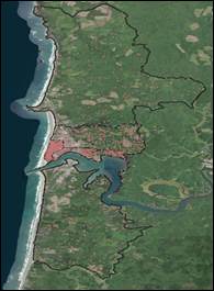
This figure shows the debris spread in Newport OR after an M9 Cascadia event, as estimated by FEMA’s HAZUS tool.

