Research on splay faults in the Cascadia Subduction Zone (CSZ) from the Cascadia CoPes Hub was recently published in a special issue of Seismica. In the article titled “Late Quaternary Surface Displacements on Accretionary Wedge Splay Faults in the Cascadia Subduction Zone: Implications for Megathrust Rupture”, graduate student researchers Anna Ledeczi and Madeleine Lucas along with investigators Harold Tobin and Janet Watt took a closer look at splay faults along the CSZ.
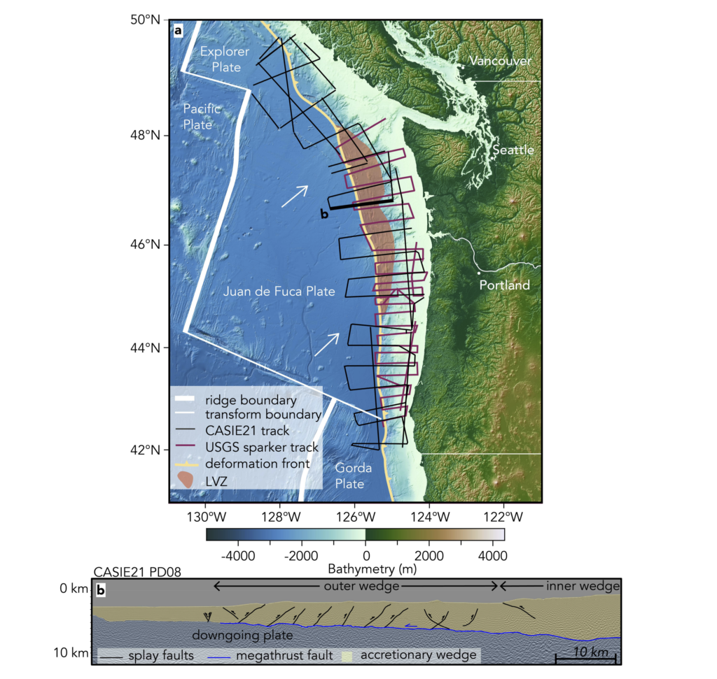
Ruptures along splay faults in the CSZ can cause larger tsunamis compared to main fault ruptures due to their steep angle. Sediment from the Juan de Fuca plate gets scraped off as it subducts under the North American plate, creating piles of sediments known as accretionary wedges at the plate boundaries. When large earthquakes occur, multiple faults within the accretionary wedge can slip, affecting tsunami size and impact. Because the last big earthquake in Cascadia was in 1700, the likelihood of splay fault activity is uncertain. This new research analyzed high-frequency seismic data and crustal-scale multi-channel seismic data to examine the most recently active offshore faults.
The data gathered spanned from Washington to northern Oregon, which will support tsunami and earthquake models to refine predictions and preparations for coastal impacts during future Cascadia earthquakes. The researchers determined there is a higher likelihood of megathrust earthquakes on multiple splay faults, which should be accounted for in future tsunami hazard modeling scenarios. Read more here.
Comments are closed